Hidden Hiking Trails in Valbona Valley National Park

Tucked into the far north of Albania, where the Accursed Mountains pierce the sky and glacial rivers carve through ancient limestone, Valbona Valley National Park stands as one of Europe's last truly wild frontiers. Most visitors arrive having heard of the famous Valbona to Theth crossing, and while that trail absolutely deserves its legendary reputation, it barely scratches the surface of what this extraordinary park has to offer. Beyond the well-worn path lie dozens of hidden trails winding through beech forests, past thundering waterfalls, over remote ridgelines, and into villages where time seems to have paused somewhere in the last century.
This guide is your invitation to go deeper. You will discover lesser-known routes that reward curiosity and a willingness to stray from the obvious. You will learn which trails suit beginners, which demand serious alpine experience, and how to navigate the practical details that make the difference between a miserable slog and the hike of your life. Albania's hiking infrastructure is developing rapidly, but Valbona still retains that raw, exploratory feeling that adventurous travelers dream about. Lace up your boots, charge your camera, and get ready to experience the Accursed Mountains the way very few visitors ever do.
Key Takeaways
| Best Season | Late May through early October, with July and August offering the most stable weather |
|---|---|
| Difficulty Range | Easy riverside walks to challenging high-alpine scrambles above 2,400 meters |
| Permit Required | No hiking permits needed, but a small national park entrance fee applies |
| Guided vs Solo | Local guides are strongly recommended for off-trail and high-ridge routes |
| Navigation | Download offline maps before you go; mobile signal is unreliable in most of the park |
| Accommodation | Guesthouses in Valbona village serve as the ideal base for multi-day exploration |
Understanding Valbona Valley: The Landscape Behind the Trails
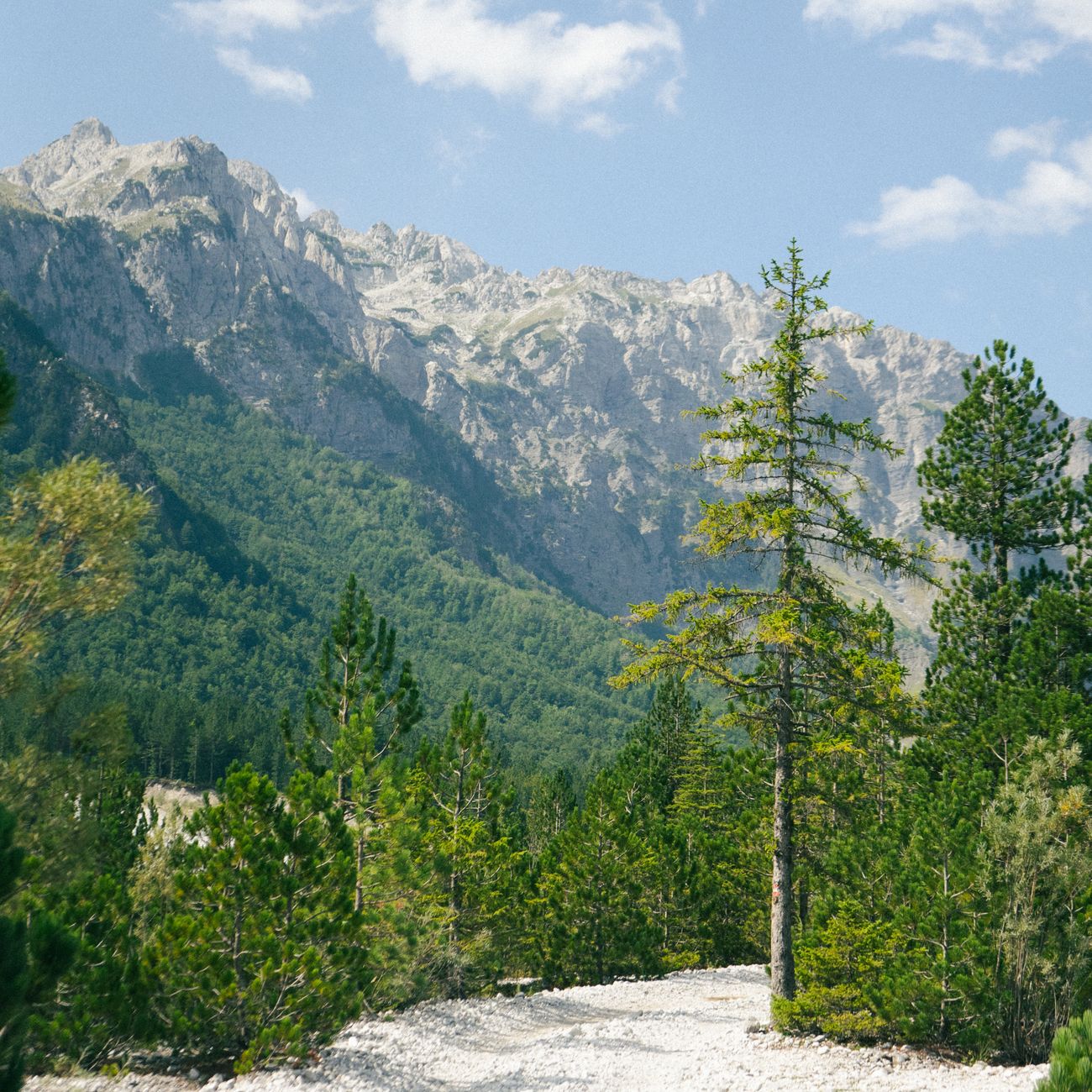
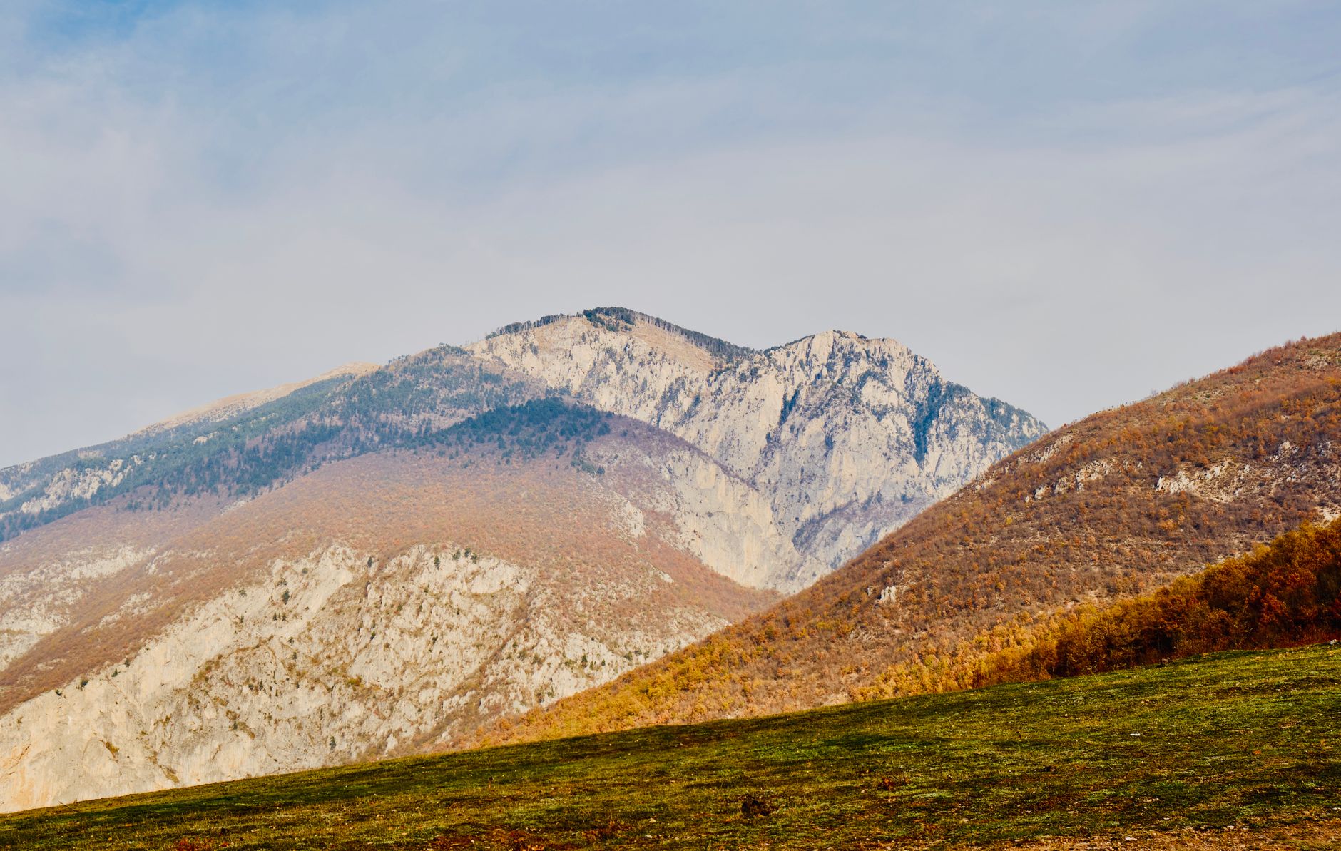
Before you set foot on any trail, it helps to understand the geography that makes Valbona so compelling and, at times, so demanding. The valley sits within the Bjeshket e Namuna range, known in English as the Accursed Mountains, a name that local legend attributes to a curse placed on the peaks after a series of tragic blood feuds. The mountains rise sharply from the valley floor, with several summits exceeding 2,500 meters, creating dramatic elevation changes that define nearly every hiking experience here.
The Valbona River runs through the heart of the valley, fed by snowmelt and underground springs, and its turquoise waters serve as both a landmark and a lifeline for hikers. The surrounding terrain shifts from dense mixed forest at lower elevations to open alpine meadows and exposed limestone ridges higher up. This variety means that within a single day you can move through completely different ecosystems, each with its own wildlife, wildflowers, and atmosphere.
The park covers roughly 8,000 hectares and borders Kosovo to the north, which means some of the more adventurous routes can take you close to international boundaries. Always check current conditions and local advice before attempting cross-border or high-ridge routes. The infrastructure within the park is minimal by design, which is precisely what preserves its wild character. Trails are often unmarked or only partially waymarked, making preparation and local knowledge essential rather than optional.
- The valley floor sits at approximately 900 meters above sea level, with trails climbing to over 2,400 meters
- Weather can change rapidly even in summer; afternoon thunderstorms are common in July and August
- The Valbona River is a reliable navigation reference on lower trails
- Wildlife includes brown bears, wolves, lynx, and golden eagles, though sightings are rare
- Limestone karst terrain creates caves, sinkholes, and springs that add geological interest to hikes
Pick up a printed topographic map from a guesthouse in Valbona village before heading out. These locally produced maps often show shepherd paths and seasonal tracks that do not appear on any digital platform.
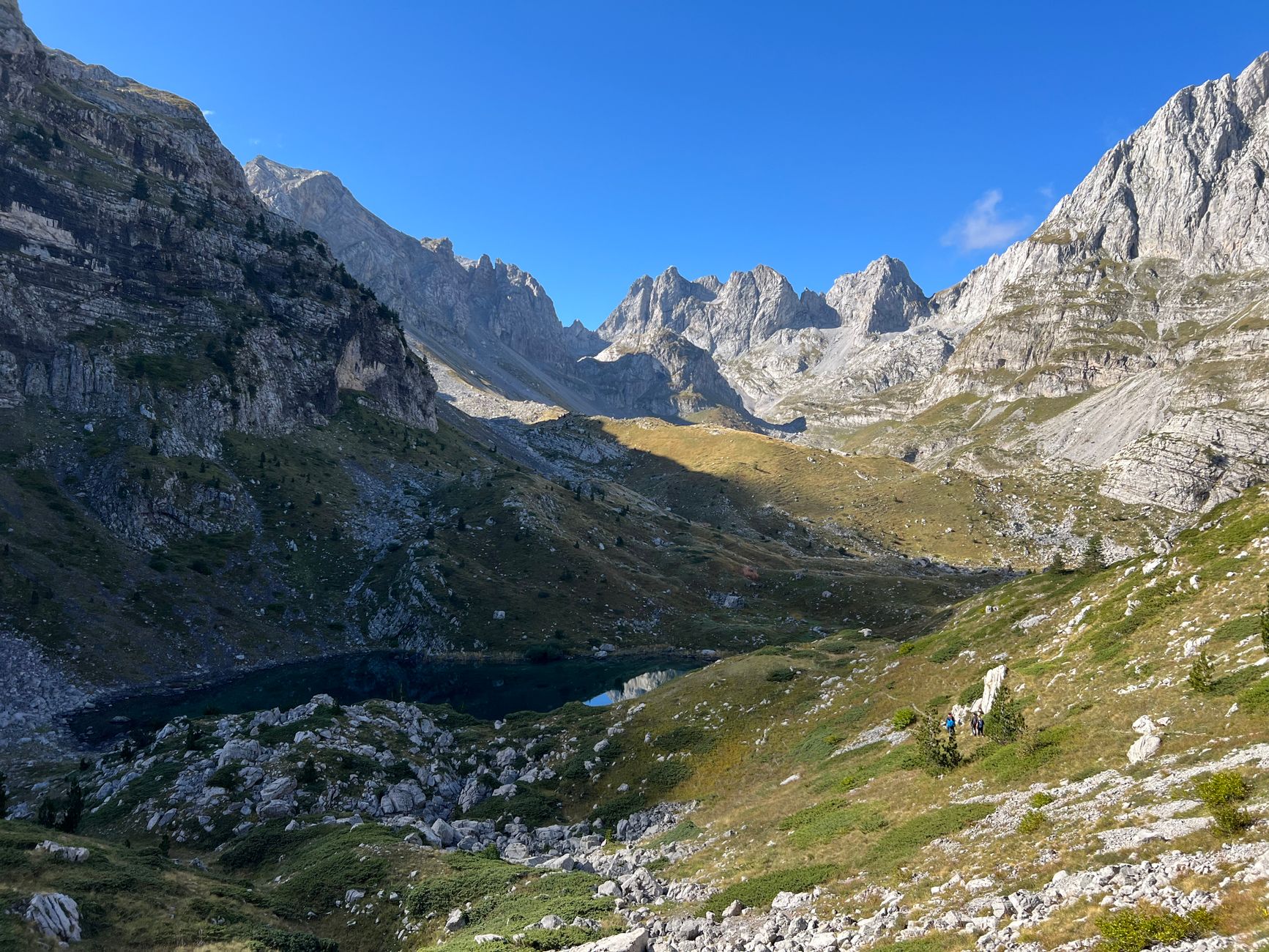
The Rragam Plateau Trail: A Hidden Alpine Gem
Of all the lesser-known routes in Valbona, the trail to the Rragam Plateau is perhaps the most rewarding for hikers who want sweeping panoramic views without the crowds that gather on the main Theth crossing. The trailhead begins near the upper end of Valbona village and climbs steadily through a mix of pine and beech forest before breaking out onto open grassland that feels almost impossibly green in midsummer.
The ascent takes roughly three to four hours at a comfortable pace, gaining around 900 meters of elevation. The path is faint in places, particularly where it crosses the open plateau, so a GPS track downloaded in advance is genuinely useful here. Once you reach the plateau itself, you are rewarded with 360-degree views of the surrounding peaks, including the imposing bulk of Jezerca, the highest summit in the Accursed Mountains at 2,694 meters.
What makes Rragam special beyond the views is the sense of solitude. On a busy summer weekend, the main Valbona-Theth trail can feel almost congested by Albanian standards, but up on the plateau you may well spend hours without seeing another soul. Local shepherds do graze their flocks here in summer, and if you are lucky, one of them may offer you fresh cheese and a glass of raki, which is about as authentic a mountain experience as you can hope for anywhere in the Balkans.
- Distance: approximately 12 kilometers round trip from Valbona village
- Elevation gain: around 900 meters to the plateau edge
- Difficulty: moderate to challenging, with some steep sections on loose scree near the top
- Best months: June through September when snow has cleared from the upper sections
- No waymarking above the treeline; GPS track or local guide strongly advised
Start this hike no later than 7am to reach the plateau before afternoon clouds build. The light on the surrounding peaks in the early morning is also dramatically better for photography.
The Curraj i Eperm Forest Loop: Perfect for Beginners
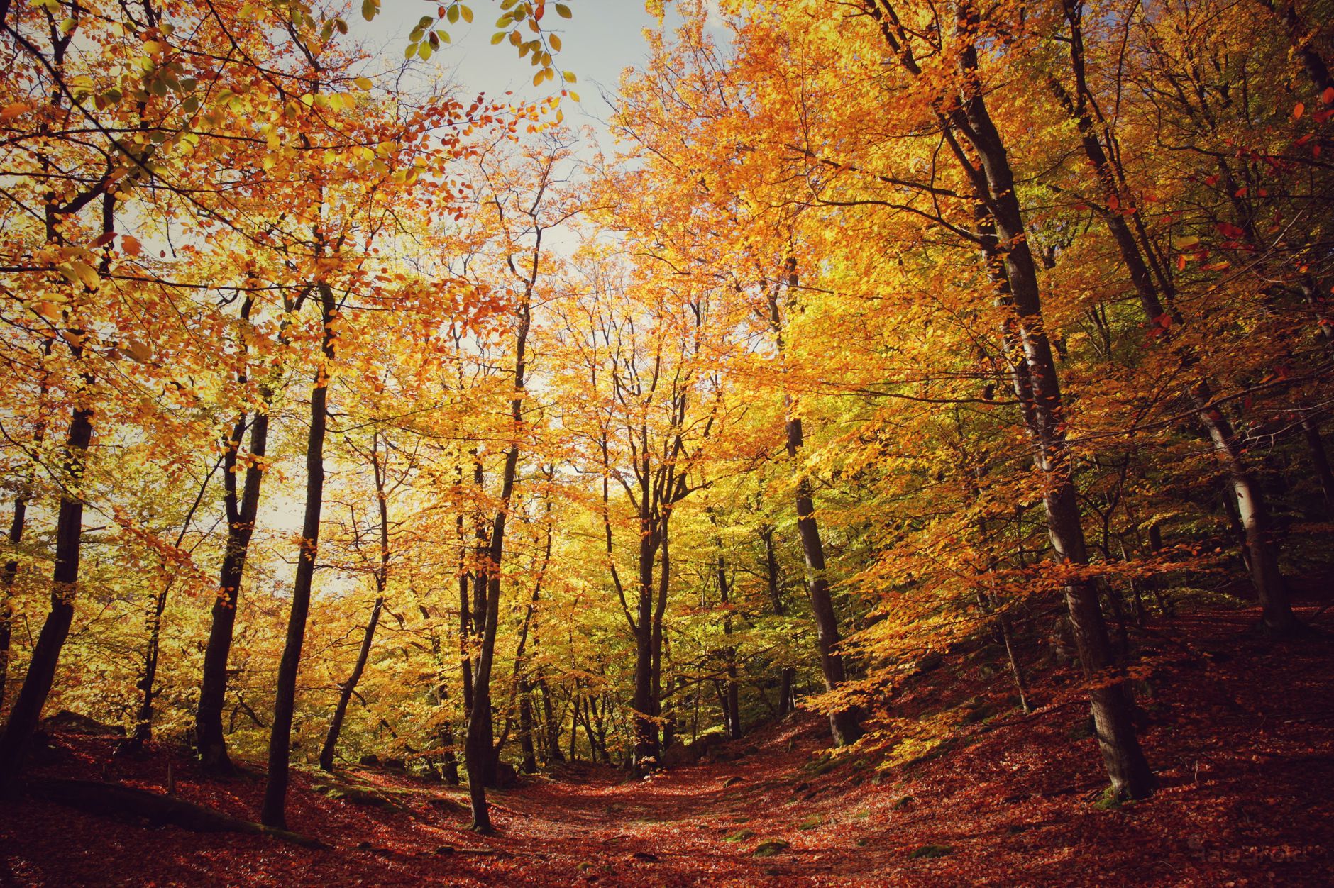
Not every trail in Valbona needs to be an epic alpine challenge, and the forest loop around the Curraj i Eperm area proves that point beautifully. This gentle circular route wanders through some of the most pristine beech and oak forest in the entire park, following the curves of a small tributary stream before looping back through a traditional mountain hamlet where wooden farmhouses and stone walls look unchanged from a century ago.
The loop covers around eight kilometers and involves minimal elevation change, making it accessible to families with older children, hikers recovering from injury, or anyone who simply wants a meditative walk through extraordinary natural scenery. The forest floor in late spring is carpeted with wildflowers, and in autumn the beech trees turn a rich amber and copper that rivals any fall foliage display in Europe.
One of the underappreciated pleasures of this route is the birdlife. The old-growth forest sections harbor woodpeckers, nuthatches, and several owl species that you are more likely to hear than see. In the early morning, the chorus of birdsong in these woods is genuinely spectacular. The trail also passes a small natural spring about halfway around the loop, where the water is cold, clean, and one of the most refreshing things you will ever taste after a few hours of walking.
- Distance: approximately 8 kilometers for the full loop
- Elevation change: minimal, under 200 meters total
- Difficulty: easy, suitable for most fitness levels
- Highlights: old-growth beech forest, traditional hamlet, natural spring, rich birdlife
- The loop is partially waymarked with red paint blazes on trees
Visit this trail in late October if your travel dates allow. The autumn colors in the beech forest are extraordinary, and the cooler temperatures make walking deeply comfortable.
The Jezerca Ridge Approach: For Experienced Alpinists Only

For experienced hikers and mountaineers who want to push into serious alpine territory, the approach route toward the Jezerca ridge system offers some of the most dramatic and demanding terrain in all of Albania. This is emphatically not a trail for beginners or those without proper mountain experience. The route involves sustained steep climbing, sections of exposed scrambling, and navigation across trackless terrain where route-finding skills are essential.
The approach begins from a point roughly six kilometers up the valley from Valbona village and climbs relentlessly for around five to six hours before reaching the high ridgeline. Along the way you pass through several distinct zones: first dense forest, then open scrub with juniper and dwarf pine, and finally bare limestone above 2,000 meters where the rock takes on an almost lunar quality. The views from the ridge are among the finest in the western Balkans, stretching north into Kosovo and south toward the distant glimmer of the Adriatic on exceptionally clear days.
A local guide is not just recommended for this route, it is essentially mandatory unless you have extensive alpine navigation experience and are comfortable on steep, loose rock. The Jezerca area has seen rescue operations involving unprepared hikers, and the remoteness of the terrain means that help can take many hours to arrive. Treat this route with the respect it deserves, plan conservatively, and the rewards are genuinely extraordinary.
- Distance: 20 to 24 kilometers round trip depending on exact route taken
- Elevation gain: approximately 1,500 meters from the valley floor
- Difficulty: very challenging, alpine grade, scrambling required on upper sections
- Equipment: helmet, trekking poles, and navigation tools are strongly recommended
- A local guide with alpine experience is essential for safety on this route
If you want to experience the upper Jezerca terrain without committing to the full ridge approach, consider hiring a local guide for a half-day ascent to the 2,000-meter mark. The views are already extraordinary at that elevation and the terrain is far more forgiving.
The Valbona River Gorge Walk: Water, Rock, and Solitude
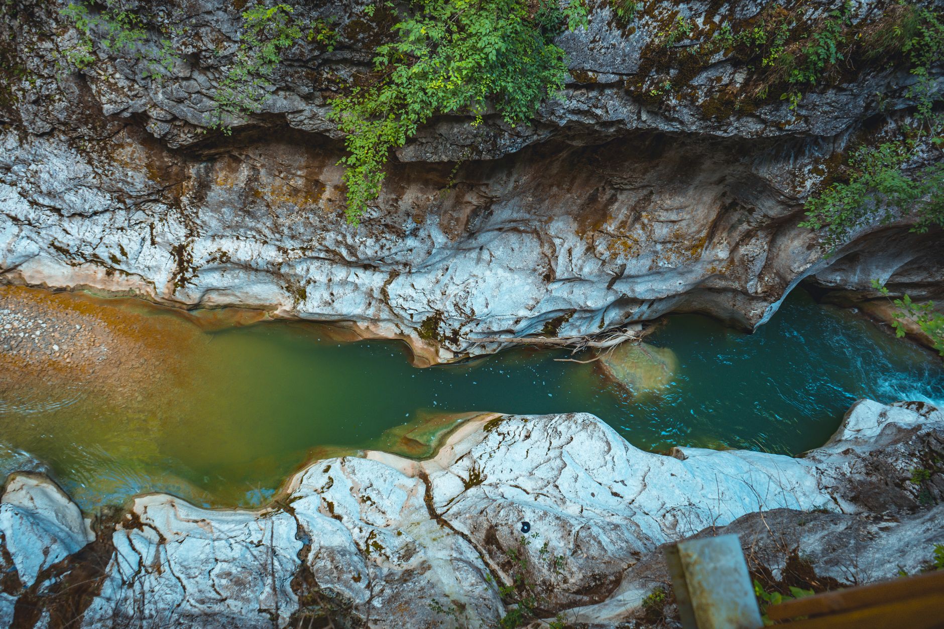
One of the most distinctive and least-visited routes in the park follows the Valbona River upstream through a narrow limestone gorge that the main road bypasses entirely. This trail keeps you close to the water for most of its length, sometimes requiring you to hop between boulders or wade through shallow sections where the path disappears into the riverbed. It is wet, occasionally awkward, and completely magnificent.
The gorge walk covers roughly ten kilometers one way, from a point near the park entrance to the upper valley where the river widens and the mountains open up dramatically. The limestone walls of the gorge rise steeply on both sides, carved by millennia of water action into smooth curves and dramatic overhangs. In several places, the gorge narrows to just a few meters wide, creating cool, shaded corridors that feel almost cathedral-like in their atmosphere.
Spring and early summer are the most dramatic times for this route, when snowmelt sends the river roaring through the gorge with impressive force. However, high water levels can make some sections impassable or genuinely dangerous, so always check local conditions before attempting this route in May or early June. By July, the river drops to a more manageable level and the gorge walk becomes a wonderful way to stay cool during the hotter summer days.
- Distance: approximately 10 kilometers one way; arrange transport back or retrace your steps
- Difficulty: moderate, with some boulder-hopping and potential shallow wading required
- Water shoes or sandals with good grip are highly recommended alongside hiking boots
- Avoid this route during or immediately after heavy rainfall when water levels rise rapidly
- The gorge offers excellent opportunities for wildlife spotting, particularly kingfishers and dippers
Bring a dry bag or waterproof phone case for this hike. The combination of river crossings, spray from rapids, and the temptation to swim in the crystal-clear pools means your gear will likely get wet.
Practical Planning: Gear, Guides, and Getting There

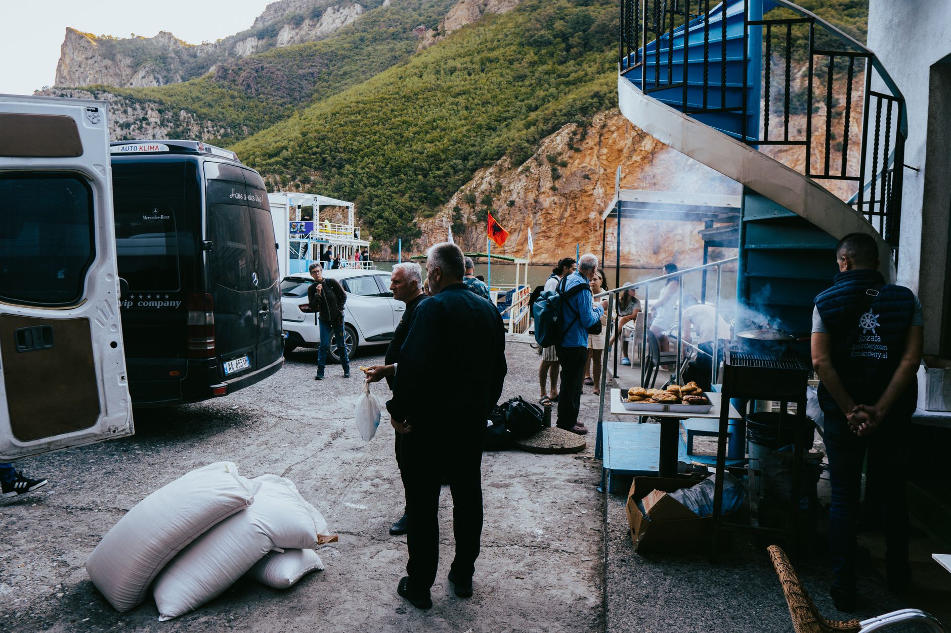
Getting to Valbona Valley requires a degree of logistical commitment that actually works in your favor as a hiker, because it filters out casual day-trippers and ensures the trails remain relatively uncrowded. The most scenic and popular approach is the ferry across Lake Koman, a two-hour boat journey through dramatic fjord-like scenery that serves as a spectacular introduction to the Albanian Alps. From the ferry terminus at Fierze, a minibus or taxi covers the remaining distance to Valbona village.
Accommodation in the valley is provided almost entirely by family-run guesthouses, and these establishments are genuinely central to the hiking experience. Guesthouse owners and their staff are often the best source of current trail information, and many can connect you with local guides who know the hidden routes intimately. Booking ahead is strongly advised from June through August, as the better guesthouses fill up quickly during peak season.
In terms of gear, Valbona demands respect. Even on moderate trails, conditions can deteriorate quickly, and the remoteness of the terrain means you cannot rely on rescue services responding rapidly. Layered clothing, waterproofs, a first-aid kit, plenty of water, and high-energy food are non-negotiable regardless of the difficulty of your chosen route. Trekking poles are particularly valuable on the steeper descents, where loose gravel and wet rock can be treacherous.
Best Time of Year to Hike
Late May through early October is the practical hiking window in Valbona, but each month has its own character. Late May and June offer wildflowers, rushing rivers, and lush green landscapes, though some high routes may still carry snow. July and August bring the most reliable weather and the longest daylight hours, making them ideal for ambitious multi-day itineraries. September is arguably the finest month of all, with stable weather, thinner crowds, and the first hints of autumn color beginning to appear in the upper forest. October can be magical for lower trails but high-alpine routes become risky as early snowfall and shorter days reduce your safety margins significantly.
- The Lake Koman ferry runs daily in summer; book your seat in advance during July and August
- Valbona village has no ATM; bring sufficient cash from Shkoder or Tirana
- Local guides can typically be arranged through your guesthouse with one to two days notice
- The national park entrance fee is modest and collected at a checkpoint near the valley entrance
- Mobile data is unreliable; download offline maps and GPS tracks before leaving the village
- Emergency services can be reached via the national emergency number 112, though response times in remote areas are slow
Pack out everything you pack in. Valbona's wilderness character depends on visitors treating the environment with care. Many guesthouses now actively promote leave-no-trace principles, and following them ensures this extraordinary place remains pristine for future hikers.
Multi-Day Itineraries: Combining the Hidden Trails

The true magic of Valbona emerges when you combine individual trails into multi-day itineraries that allow you to move deeper into the park and experience the landscape across different times of day and shifting weather conditions. A three-day base-camp approach, using Valbona village as your hub, lets you tackle the Rragam Plateau on day one, the river gorge walk on day two, and the forest loop on day three, giving you a comprehensive taste of the valley's diversity without the logistical complexity of moving accommodation each night.
For those with more time and a higher fitness level, a four to five day point-to-point route can be designed with local guide assistance that links Valbona with remote shepherd settlements, crosses high passes, and descends into adjacent valleys that see almost no tourist traffic whatsoever. These routes are not documented in any guidebook and essentially exist only in the knowledge of local mountain people, which is precisely what makes them so special.
Wild camping is technically possible in some areas of the park, though regulations are evolving and it is worth confirming current rules with park authorities or your guesthouse before pitching a tent. The alternative, staying in the network of simple mountain guesthouses scattered through the upper valley, is actually preferable in most cases. The food is extraordinary, the beds are comfortable after a long day on the trail, and the conversations with hosts and fellow travelers are often as memorable as the hiking itself.
- A three-day base-camp itinerary from Valbona village covers the park's main hidden trail types
- Multi-day point-to-point routes require local guide support and advance logistical planning
- Guesthouse-to-guesthouse trekking eliminates the need to carry camping equipment
- Build at least one rest day into any itinerary of four days or more to allow for weather delays
- The combination of the gorge walk and Rragam Plateau in a single two-day sequence is particularly recommended
Ask your guesthouse host to prepare a packed lunch for any full-day hike. The homemade bread, local cheese, and seasonal vegetables they provide are infinitely better than anything you could carry from a shop, and supporting local food producers is one of the most meaningful ways to contribute to the valley's economy.
Valbona Hidden Trails at a Glance
| Trail Name | Distance | Difficulty | Best Season | Guide Needed |
|---|---|---|---|---|
| Rragam Plateau Trail | 12 km round trip | Moderate to Challenging | June to September | Recommended |
| Curraj i Eperm Forest Loop | 8 km loop | Easy | May to October | Not required |
| Jezerca Ridge Approach | 20 to 24 km round trip | Very Challenging | July to August | Essential |
| Valbona River Gorge Walk | 10 km one way | Moderate | July to September | Optional |
| Upper Valley Shepherd Routes | Variable | Challenging | June to September | Essential |
Frequently Asked Questions
Do I need a permit to hike in Valbona Valley National Park?
No hiking permit is required, but you will need to pay a small national park entrance fee at the checkpoint near the valley entrance. The fee is modest and goes toward park maintenance. Simply have some local currency ready when you arrive.
Is it safe to hike the hidden trails without a guide?
It depends entirely on the trail. The forest loop and lower river walk are manageable without a guide for hikers with basic navigation skills and offline maps. However, the Rragam Plateau trail, the Jezerca ridge approach, and any multi-day point-to-point routes should only be attempted with an experienced local guide. The terrain is remote, trails are often unmarked, and rescue response times are slow.
What is the best way to get to Valbona Valley from Tirana?
The classic route involves taking a bus or shared taxi from Tirana to Shkoder, then a minibus to Koman, followed by the spectacular Lake Koman ferry to Fierze, and finally a minibus or taxi to Valbona village. The entire journey takes roughly eight to ten hours. Alternatively, some travelers drive or hire a taxi for the full journey, which reduces travel time but misses the extraordinary ferry experience.
Can I hike in Valbona in October and November?
October can be excellent for lower trails, with beautiful autumn foliage and fewer crowds. However, high-alpine routes become increasingly risky as early snowfall arrives and daylight hours shorten. By November, most guesthouses have closed for the season and conditions on higher trails are genuinely dangerous. If you visit in October, stick to the forest loop and lower gorge sections and always check local conditions before heading out.
Are there any trails suitable for families with young children?
Yes, the Curraj i Eperm Forest Loop is well suited to families with older children who are comfortable walking eight kilometers on gentle terrain. The lower sections of the river gorge walk are also accessible and exciting for children, with the river crossings and rock-hopping adding an adventurous element. Avoid any high-alpine routes with children unless they are experienced young hikers.
How do I find a local hiking guide in Valbona?
The easiest way is to ask at your guesthouse. Most guesthouse owners either guide themselves or have strong connections with trusted local guides who know the hidden trails intimately. It is worth booking a guide at least one to two days in advance during peak season. Rates are very reasonable by European standards and the knowledge and safety these guides provide is genuinely invaluable on the more challenging routes.
Plan your Albania adventure
Valbona Valley National Park is one of those rare places that still has the power to genuinely surprise you, to take your breath away not just with its physical beauty but with the feeling that you have discovered something the rest of the world has not quite caught up with yet. The hidden trails described in this guide represent only a fraction of what the park contains. Every season, every weather condition, every conversation with a local shepherd or guesthouse host opens up new possibilities and reveals another layer of this extraordinary landscape. The Accursed Mountains earned their dramatic name, but for hikers willing to explore them properly, they offer something closer to a blessing.
So plan carefully, pack well, respect the environment, and go. Walk the plateau at dawn when the peaks glow amber in the early light. Follow the river through the gorge and let the cold water wake you up completely. Sit in a shepherd's meadow above the treeline and eat cheese and bread while eagles circle overhead. These are not experiences you find on a highlights reel or a tourist itinerary. They are the rewards that come to travelers who choose the hidden path, and in Valbona, the hidden path is always worth taking.